Looking for a powerful, all-in-one mapping and navigation solution? 2GIS delivers accurate offline maps, real-time GPS navigation, live traffic updates, detailed transit routes, parking information, and much more—all in one intuitive app. Whether you're driving, walking, cycling, or using public transport, 2GIS helps you get there faster and smarter.
2GIS is more than just a map—it’s your complete city guide. Access everything from addresses and business listings to operating hours, phone numbers, services, and reviews. Use it online or download maps for offline use, ensuring you never lose your way—even without an internet connection.
Why Choose 2GIS?
- Offline Maps: Download maps to your device and navigate anytime, anywhere—even with no internet access.
- Accurate Location Data: Find districts, streets, buildings, bus stops, metro stations, gas stations, sports facilities, and more with precision.
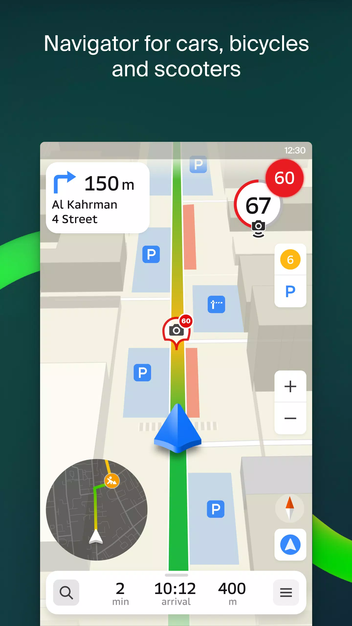
- Real-Time GPS Navigation: Get turn-by-turn directions tailored to your mode of travel—by car, foot, bike, or public transport.
- Live Traffic Updates: Avoid delays with real-time traffic data, including jams, road closures, and speed cameras reported by users.
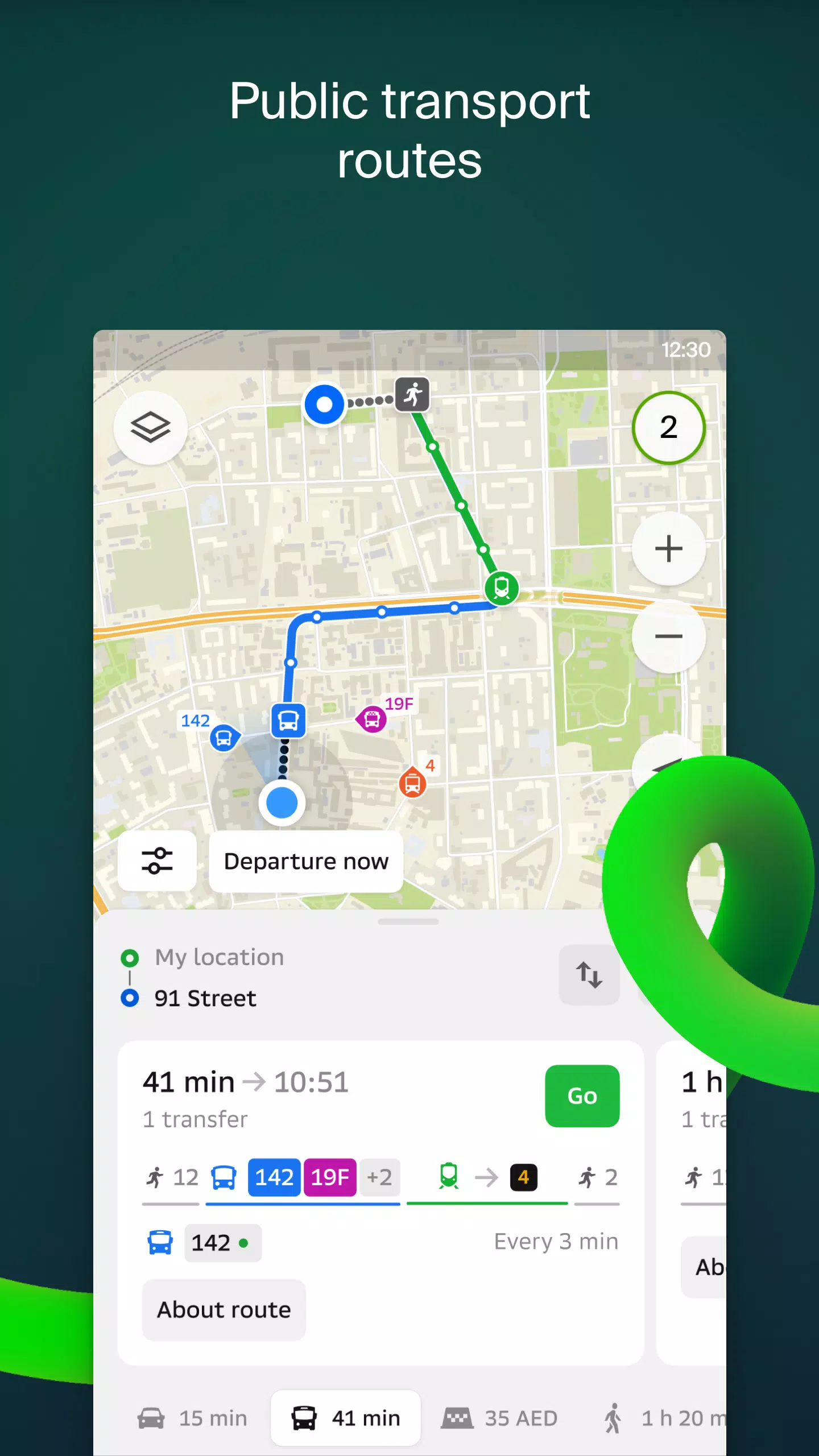
- Transit Schedules & Routes: Plan your journey with up-to-date public transport timetables and route options across cities.
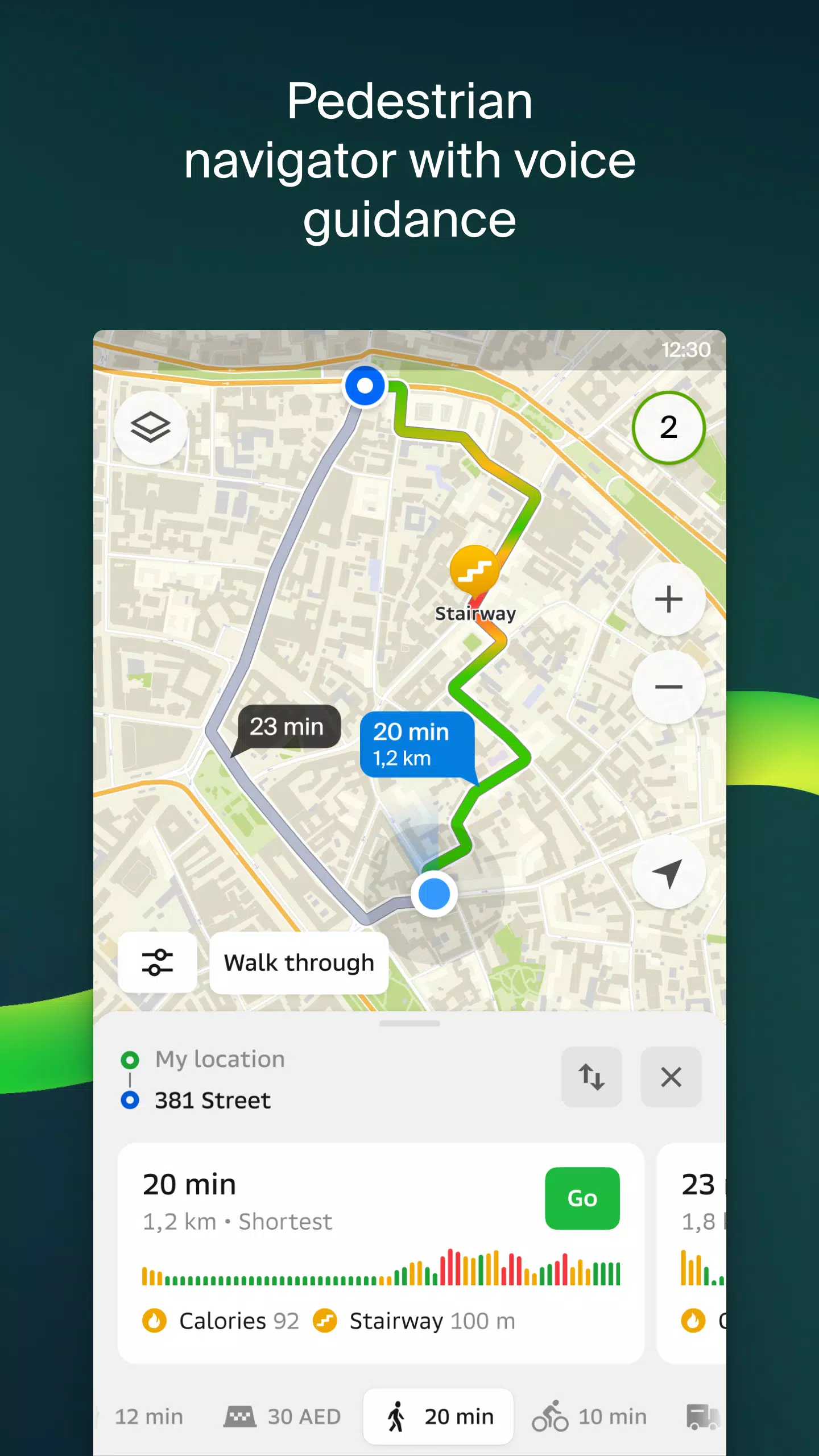
- Pedestrian Navigation: Discover optimized walking paths and enjoy voice guidance that works even when the app runs in the background.
- Truck Navigation: Specialized routing for cargo vehicles, considering vehicle dimensions, weight, and load restrictions.
- Friends' Location Tracking: Share your location safely with friends and family, view their positions on the map, and exchange stickers or battery status updates.
- Detailed Business Directory: Search for companies, view addresses, contact details, social media links, photos, and customer reviews.
- Travel Guide: Discover top attractions, free Wi-Fi spots, and must-visit locations directly on the map.
- Smartwatch Integration: Stay on track with the 2GIS Wear OS companion app. Get route visuals, maneuver alerts, and vibration notifications while navigating on foot, bike, or public transport.
Available Cities
2GIS covers major cities across multiple countries, making it a reliable choice for both locals and travelers. Available in:
- UAE: Dubai, Sharjah, Abu Dhabi, Al Ain, Ajman, Ras Al Khaimah, Fujairah, Umm Al Quwain, Dibba Al Fujairah, Khor Fakkan, Kalba, Al Salamh, and more.
- Russia: Moscow, Saint Petersburg, Novosibirsk, Ekaterinburg, Krasnoyarsk, Chelyabinsk, Ufa, Omsk, Kazan, Perm, Nizhny Novgorod, Sheregesh, and others.
- Belarus, Kazakhstan, Uzbekistan, Azerbaijan, Kyrgyzstan: Minsk, Pavlodar, Semey, Aktau, Aktobe, Almaty, Nur-Sultan (Astana), Bishkek, Karaganda, Kokshetau, Kostanay, Osh, Baku, Tashkent, and many more.
Whether you're exploring a new city, commuting daily, or managing logistics, 2GIS provides the tools you need to navigate efficiently and confidently. Download today and experience the power of intelligent mapping.
Need Help?
For support or feedback, reach out to the 2GIS team at [email protected]. We’re here to help make your journey smoother.