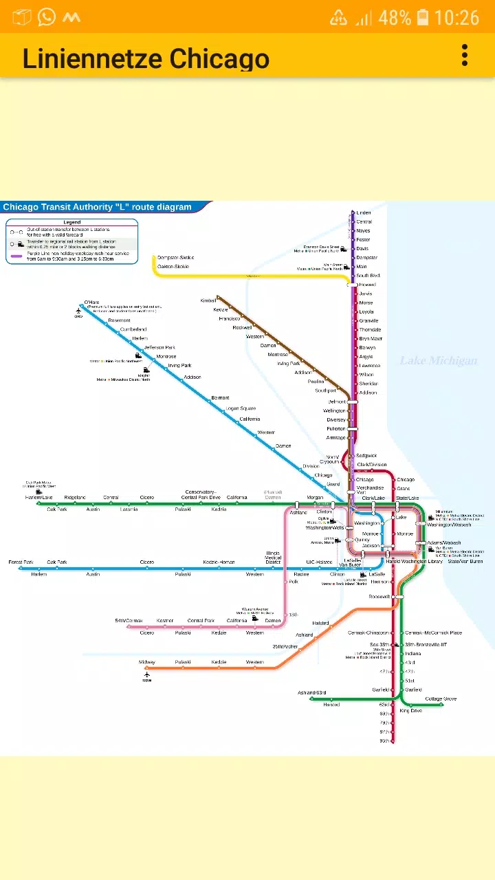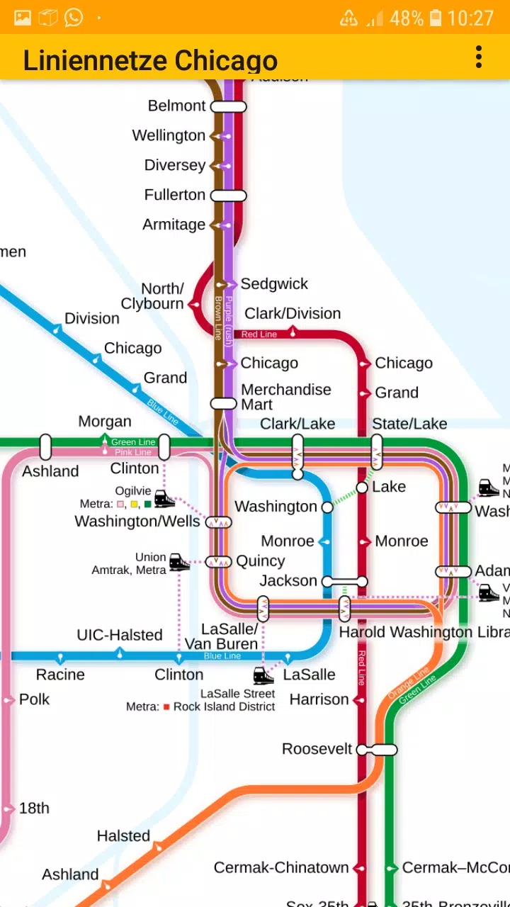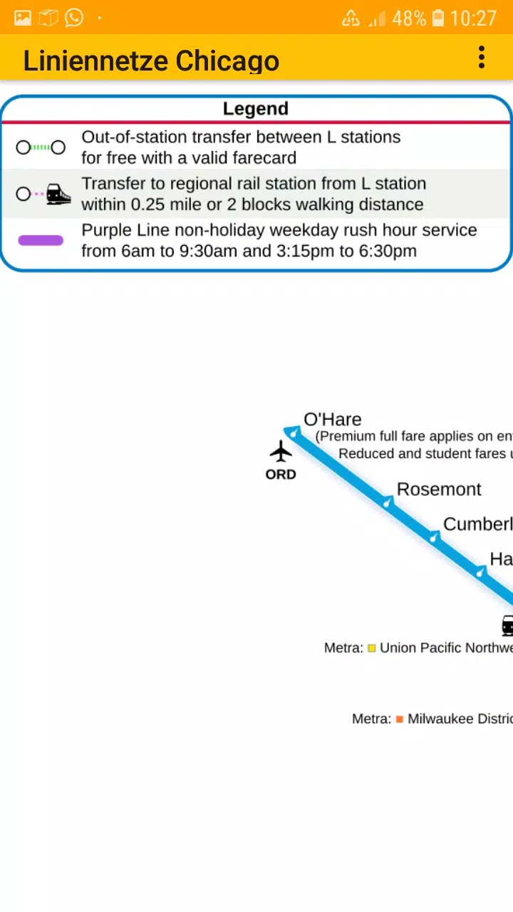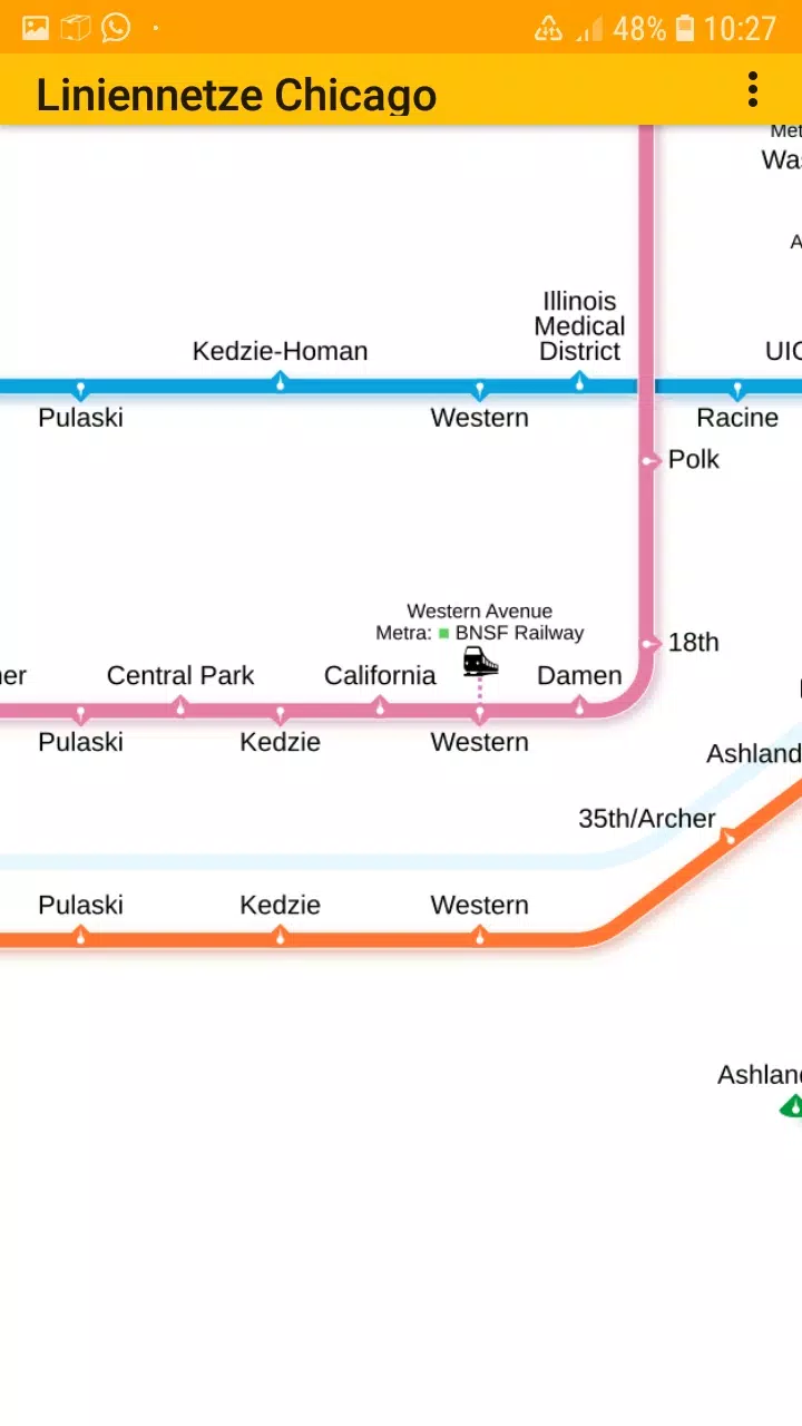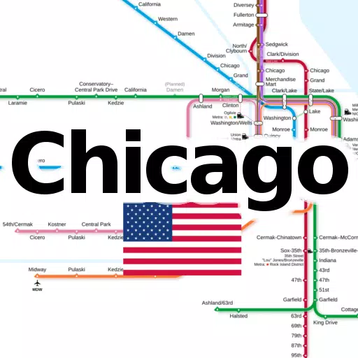
Discover all essential subway and railroad maps of Chicago consolidated into one convenient application. With this app, you can access the following line networks offline, without the need for any additional downloads:
- Chicago elevated "L" rapid transit system
Social Media: Follow us on Facebook: https://www.facebook.com/203994253076876
Homepage: Visit our site at: https://dieeinsteiger.blogspot.com
Designed for both Chicago locals and tourists, this app offers easy-to-use, zoomable line network maps. Simply scroll around and zoom in or out to explore the transit system at your convenience. The app features multiple tabs, each displaying different types of transit maps.
The metro line network, often referred to as the underground, rail transit map, urban tube map, or public subway, is readily available for your navigation needs.
We value your input! Share your suggestions for improvements, ideas, wishes, or general feedback via email or through the contact form on our website: https://dieeinsteiger.blogspot.com/p/kontakt.html
Notices:
- Compatible with phones and tablets running Android 4.4 (KitKat, API 19) to Android 13.0 (API 33).
- Please note that the app's content may not be entirely accurate or complete.
- The maps embedded in this app are subject to the Creative Commons license (CC BY-SA 4.0) and were created by Chinese Wikipedia user Sameboat, the copyright holder.
Enjoy exploring the transit maps of Chicago with ease! Available now on the Google Play Store, brought to you by dieEinsteiger.
What's New in Version 1.3
Last updated on Oct 20, 2024
v1.3 (06-08-2024)
- Updated to Android API 35